চিত্র:Map indicating Amundsen Gulf, Northwest Territories, Canada.png
Map_indicating_Amundsen_Gulf,_Northwest_Territories,_Canada.png (৩৯৫ × ৩৭০ পিক্সেল, ফাইলের আকার: ৬০ কিলোবাইট, এমআইএমই ধরন: image/png)
| এই ফাইলটি উইকিমিডিয়া কমন্স থেকে নেওয়া। সেখানের বর্ণনা পাতার বিস্তারিত নিম্নে দেখানো হলো। (সম্পাদনা)
|
সারাংশ
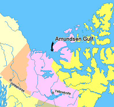
Map indicating Amundsen Gulf, Northwest Territories, Canada.
© Her Majesty the Queen in Right of Canada, Department of Natural Resources. All rights reserved.
Licence Agreement
লাইসেন্স প্রদান

|
The copyright holder of this work allows anyone to use it for any purpose including unrestricted redistribution, commercial use, and modification.
Usage notes:
|
ফাইলের ইতিহাস
যেকোনো তারিখ/সময়ে ক্লিক করে দেখুন ফাইলটি তখন কী অবস্থায় ছিল।
| তারিখ/সময় | সংক্ষেপচিত্র | মাত্রা | ব্যবহারকারী | মন্তব্য | |
|---|---|---|---|---|---|
| বর্তমান | ০১:৪২, ২১ মার্চ ২০০৬ | | ৩৯৫ × ৩৭০ (৬০ কিলোবাইট) | David Kernow~commonswiki | Map indicating Amundsen Gulf, Northwest Territories, Canada. {{legend|#ffff66|Nunavut}} {{legend|#ffccff|Northwest Territories}} {{legend|#ffcc99|Yukon Territory}} {{legend|#ffff99|British Columbia}} {{legend|#ffffcc|Alaska}} <br> © |
সংযোগসমূহ
নিচের পৃষ্ঠা(গুলো) থেকে এই ছবিতে সংযোগ আছে:
ফাইলের বৈশ্বিক ব্যবহার
নিচের অন্যান্য উইকিগুলো এই ফাইলটি ব্যবহার করে:
- af.wikipedia.org-এ ব্যবহার
- az.wikipedia.org-এ ব্যবহার
- bg.wikipedia.org-এ ব্যবহার
- bs.wikipedia.org-এ ব্যবহার
- cs.wikipedia.org-এ ব্যবহার
- de.wikipedia.org-এ ব্যবহার
- en.wikipedia.org-এ ব্যবহার
- eo.wikipedia.org-এ ব্যবহার
- es.wikipedia.org-এ ব্যবহার
- et.wikipedia.org-এ ব্যবহার
- eu.wikipedia.org-এ ব্যবহার
- fa.wikipedia.org-এ ব্যবহার
- fr.wikipedia.org-এ ব্যবহার
- fy.wikipedia.org-এ ব্যবহার
- hi.wikipedia.org-এ ব্যবহার
- ilo.wikipedia.org-এ ব্যবহার
- it.wikipedia.org-এ ব্যবহার
- ja.wikipedia.org-এ ব্যবহার
- ka.wikipedia.org-এ ব্যবহার
- ko.wikipedia.org-এ ব্যবহার
- ku.wikipedia.org-এ ব্যবহার
- la.wikipedia.org-এ ব্যবহার
- lt.wikipedia.org-এ ব্যবহার
- mk.wikipedia.org-এ ব্যবহার
- nl.wikipedia.org-এ ব্যবহার
- nn.wikipedia.org-এ ব্যবহার
- pa.wikipedia.org-এ ব্যবহার
- pl.wikipedia.org-এ ব্যবহার
- pl.wiktionary.org-এ ব্যবহার
- pnb.wikipedia.org-এ ব্যবহার
- sh.wikipedia.org-এ ব্যবহার
- sl.wikipedia.org-এ ব্যবহার
- sr.wikipedia.org-এ ব্যবহার
- tr.wikipedia.org-এ ব্যবহার
- uk.wikipedia.org-এ ব্যবহার
- ur.wikipedia.org-এ ব্যবহার
- vi.wikipedia.org-এ ব্যবহার
- war.wikipedia.org-এ ব্যবহার
- xmf.wikipedia.org-এ ব্যবহার
- zh-min-nan.wikipedia.org-এ ব্যবহার
- zh.wikipedia.org-এ ব্যবহার