চিত্র:IsraelCVFRtopography.jpg
এই প্রাকদর্শনের আকার: ৪৪৬ × ৫৯৯ পিক্সেল। অন্যান্য আকারসমূহ: ১৭৯ × ২৪০ পিক্সেল | ৩৫৭ × ৪৮০ পিক্সেল | ৫৭২ × ৭৬৮ পিক্সেল | ১,২৩৩ × ১,৬৫৬ পিক্সেল।
পূর্ণ রেজোলিউশন (১,২৩৩ × ১,৬৫৬ পিক্সেল, ফাইলের আকার: ১৯১ কিলোবাইট, এমআইএমই ধরন: image/jpeg)
| এই ফাইলটি উইকিমিডিয়া কমন্স থেকে নেওয়া। সেখানের বর্ণনা পাতার বিস্তারিত নিম্নে দেখানো হলো। (সম্পাদনা)
|
| বিবরণ | |||
| তারিখ | |||
| উৎস | Aeronautical Information Publication - Domestic (AIP) of the Israel Civil Aviation Administration – presently Civil Aviation Authority (CAA) | ||
| লেখক | Etan Tal | ||
| অনুমতি (এ ফাইলের পুনঃব্যবহার) |
|
ফাইলের ইতিহাস
যেকোনো তারিখ/সময়ে ক্লিক করে দেখুন ফাইলটি তখন কী অবস্থায় ছিল।
| তারিখ/সময় | সংক্ষেপচিত্র | মাত্রা | ব্যবহারকারী | মন্তব্য | |
|---|---|---|---|---|---|
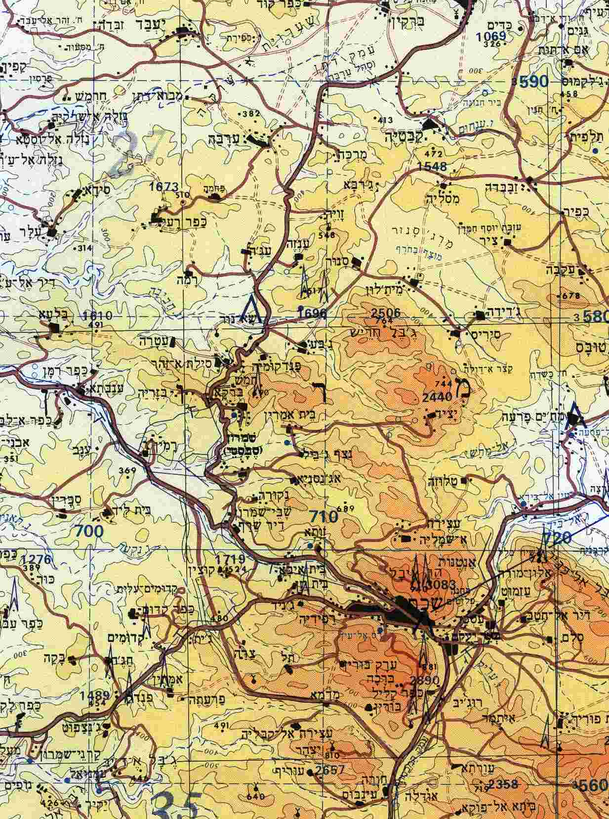
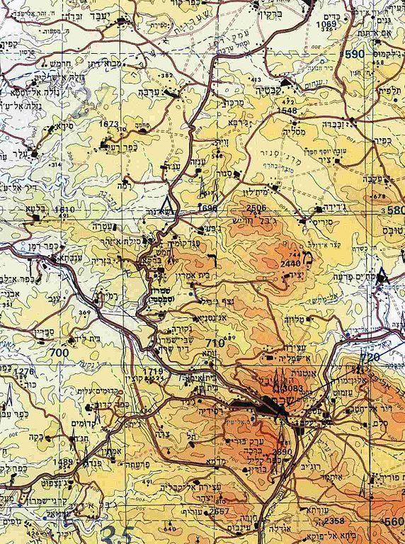
| বর্তমান | ১২:২৯, ৮ অক্টোবর ২০০৯ | | ১,২৩৩ × ১,৬৫৬ (১৯১ কিলোবাইট) | Etan J. Tal | {{Information |Description={{en|1=Section of topographical map of Nablus area (West Bank)}} |Source=Aeronautical Information Publication - Domestic (AIP) of the Israel Civil Aviation Administration – presently Civil Aviation Authority (CAA) |Aut |
সংযোগসমূহ
নিচের পৃষ্ঠা(গুলো) থেকে এই ছবিতে সংযোগ আছে:
ফাইলের বৈশ্বিক ব্যবহার
নিচের অন্যান্য উইকিগুলো এই ফাইলটি ব্যবহার করে:
- ar.wikipedia.org-এ ব্যবহার
- arz.wikipedia.org-এ ব্যবহার
- ast.wikipedia.org-এ ব্যবহার
- ca.wikipedia.org-এ ব্যবহার
- ceb.wikipedia.org-এ ব্যবহার
- diq.wikipedia.org-এ ব্যবহার
- el.wikipedia.org-এ ব্যবহার
- en.wikipedia.org-এ ব্যবহার
- eo.wikipedia.org-এ ব্যবহার
- es.wikipedia.org-এ ব্যবহার
- eu.wikipedia.org-এ ব্যবহার
- gl.wikipedia.org-এ ব্যবহার
- he.wikipedia.org-এ ব্যবহার
- hu.wikipedia.org-এ ব্যবহার
- ko.wikipedia.org-এ ব্যবহার
- ml.wikipedia.org-এ ব্যবহার
- nl.wikipedia.org-এ ব্যবহার
- nn.wikipedia.org-এ ব্যবহার
- pt.wikipedia.org-এ ব্যবহার
- ro.wikipedia.org-এ ব্যবহার
- uk.wikipedia.org-এ ব্যবহার
- vi.wikipedia.org-এ ব্যবহার
- www.wikidata.org-এ ব্যবহার