চিত্র:Hawaii Islands.PNG
এর চেয়ে বেশি রেজোলিউশন লভ্য নয়।
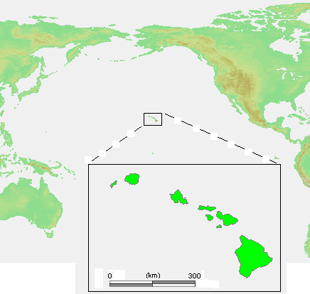
Hawaii_Islands.PNG (৪৩৬ × ৪১৪ পিক্সেল, ফাইলের আকার: ২৬ কিলোবাইট, এমআইএমই ধরন: image/png)
| এই ফাইলটি উইকিমিডিয়া কমন্স থেকে নেওয়া। সেখানের বর্ণনা পাতার বিস্তারিত নিম্নে দেখানো হলো। (সম্পাদনা)
|
সারাংশ

|
This locator map image could be re-created using vector graphics as an SVG file. This has several advantages; see Commons:Media for cleanup for more information. If an SVG form of this image is available, please upload it and afterwards replace this template with
{{vector version available|new image name}}.
It is recommended to name the SVG file “Hawaii Islands.svg”—then the template Vector version available (or Vva) does not need the new image name parameter. |
| বিবরণ | Hawaii Islands.PNG |
| উৎস | own work based on PD map |
| লেখক | edited by M.Minderhoud |
| অনুমতি (এ ফাইলের পুনঃব্যবহার) |
PD-demis |
| অন্যান্য সংস্করণ | এই ফাইলের উপজাত কর্মসমূহ: Hawaii Islands sm.PNG |
লাইসেন্স প্রদান
This image is in the public domain because it came from the site https://www.demis.nl/products/web-map-server/examples/ and was released by the copyright holder. Permission is granted to copy, distribute and/or modify this map since it is based on free of copyright images from: www.demis.nl. See also approval email on de.wp and its clarification.
|
| This work has been released into the public domain by its copyright holder, www.demis.nl. This applies worldwide. কিছু দেশে এটি আইনত সিদ্ধ নাও হতে পারে, যদি তাই হয়: www.demis.nl যে-কাউকে যেকোনো উদ্দেশ্যে, বিনাশর্তে এই কাজটি ব্যবহারের অনুমতি প্রদান করেন, যদি না সেই শর্তগুলো আইনত প্রয়োজনীয় হয়।
|
ফাইলের ইতিহাস
যেকোনো তারিখ/সময়ে ক্লিক করে দেখুন ফাইলটি তখন কী অবস্থায় ছিল।
| তারিখ/সময় | সংক্ষেপচিত্র | মাত্রা | ব্যবহারকারী | মন্তব্য | |
|---|---|---|---|---|---|
| বর্তমান | ১৩:২৬, ২৩ জুলাই ২০০৬ | | ৪৩৬ × ৪১৪ (২৬ কিলোবাইট) | Michiel1972 | {{Information |Description= {{subst:PAGENAME}} |Source= own work based on PD map |Date= |Author= edited by M.Minderhoud |Permission= {{PD-Demis}} |other_versions= }} category:Locator maps of islands |
সংযোগসমূহ
এই ফাইল ব্যবহার করে এমন কোনো পাতা নেই।
ফাইলের বৈশ্বিক ব্যবহার
নিচের অন্যান্য উইকিগুলো এই ফাইলটি ব্যবহার করে:
- de.wikipedia.org-এ ব্যবহার
- en.wikipedia.org-এ ব্যবহার
- es.wikipedia.org-এ ব্যবহার
- et.wikipedia.org-এ ব্যবহার
- fr.wikipedia.org-এ ব্যবহার
- lt.wikipedia.org-এ ব্যবহার
- pl.wiktionary.org-এ ব্যবহার
- ru.wikibooks.org-এ ব্যবহার
- tt.wikipedia.org-এ ব্যবহার