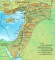
চিত্র:Dioecesis Orientis 400 AD.png

এই প্রাকদর্শনের আকার: ৫৫৪ × ৬০০ পিক্সেল। অন্যান্য আকারসমূহ: ২২২ × ২৪০ পিক্সেল | ৬২০ × ৬৭১ পিক্সেল।
পূর্ণ রেজোলিউশন (৬২০ × ৬৭১ পিক্সেল, ফাইলের আকার: ৩৭৩ কিলোবাইট, এমআইএমই ধরন: image/png)
ফাইলের ইতিহাস
যেকোনো তারিখ/সময়ে ক্লিক করে দেখুন ফাইলটি তখন কী অবস্থায় ছিল।
| তারিখ/সময় | সংক্ষেপচিত্র | মাত্রা | ব্যবহারকারী | মন্তব্য | |
|---|---|---|---|---|---|
| বর্তমান | ১৭:৪৮, ১৯ সেপ্টেম্বর ২০০৭ |  | ৬২০ × ৬৭১ (৩৭৩ কিলোবাইট) | Cplakidas | {{Information |Description=Map of the en:Diocese of the East (''Dioecesis Orientis'') ca. 400 AD, showing the subordinate provinces and the major cities. |Source=Base map found at en:Topographic map#Global 1-kilometer map, otherwise self-made. |
সংযোগসমূহ
নিচের পৃষ্ঠা(গুলো) থেকে এই ছবিতে সংযোগ আছে:
ফাইলের বৈশ্বিক ব্যবহার
নিচের অন্যান্য উইকিগুলো এই ফাইলটি ব্যবহার করে:
- ar.wikipedia.org-এ ব্যবহার
- ast.wikipedia.org-এ ব্যবহার
- azb.wikipedia.org-এ ব্যবহার
- ba.wikipedia.org-এ ব্যবহার
- be.wikipedia.org-এ ব্যবহার
- bg.wikipedia.org-এ ব্যবহার
- br.wikipedia.org-এ ব্যবহার
- ca.wikipedia.org-এ ব্যবহার
- cy.wikipedia.org-এ ব্যবহার
- de.wikipedia.org-এ ব্যবহার
- el.wikipedia.org-এ ব্যবহার
- en.wikipedia.org-এ ব্যবহার
- Decapolis
- Orient
- Bilad al-Sham
- Arab Christians
- Coele-Syria
- Al-Harith ibn Jabalah
- Antiochia ad Cragum
- Limes Arabicus
- List of revolutions and rebellions
- Mesopotamia (Roman province)
- Diocese of the East
- History of the Roman Empire
- History of Palestine
- Syria Prima
- Al-Mundhir III ibn al-Harith
- History of the Romans in Arabia
- Samaritan revolts
- Euphratensis
- Palaestina Salutaris
- Classical Anatolia
- Transjordan (region)
- Phoenice (Roman province)
এই ফাইলের অন্যান্য বৈশ্বিক ব্যবহার দেখুন।