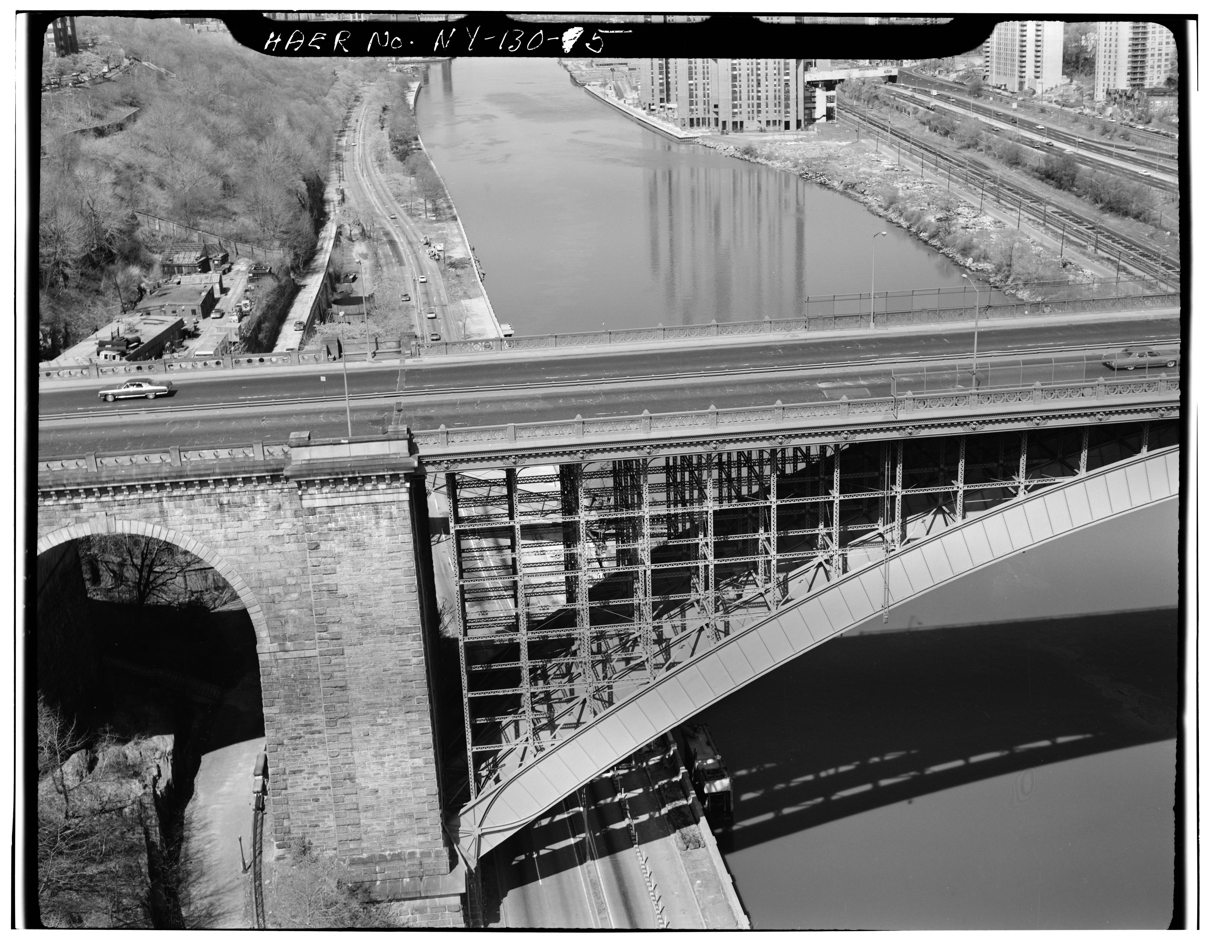
চিত্র:DETAIL OF MASONRY ARCH APPROACH SPAN ON THE MANHATTAN SIDE - Washington Bridge, Spanning Harlem River at One-hundred-eighty-first, New York, New York County, NY HAER NY,31-NEYO,162-5.tif

এই TIF ফাইলের জন্য এই JPG প্রাকদর্শনের আকার: ৭৭১ × ৫৯৯ পিক্সেল। অন্যান্য আকারসমূহ: ৩০৯ × ২৪০ পিক্সেল | ৬১৮ × ৪৮০ পিক্সেল | ৯৮৮ × ৭৬৮ পিক্সেল | ১,২৮০ × ৯৯৫ পিক্সেল | ২,৫৬০ × ১,৯৯০ পিক্সেল | ৫,০০০ × ৩,৮৮৭ পিক্সেল।
পূর্ণ রেজোলিউশন (৫,০০০ × ৩,৮৮৭ পিক্সেল, ফাইলের আকার: ১৮.৫৪ মেগাবাইট, এমআইএমই ধরন: image/tiff)
| এই ফাইলটি উইকিমিডিয়া কমন্স থেকে নেওয়া। সেখানের বর্ণনা পাতার বিস্তারিত নিম্নে দেখানো হলো। (সম্পাদনা)
|
সারাংশ
| DETAIL OF MASONRY ARCH APPROACH SPAN ON THE MANHATTAN SIDE - Washington Bridge, Spanning Harlem River at One-hundred-eighty-first, New York, New York County, NY | ||||
|---|---|---|---|---|
| আলোকচিত্রশিল্পী |
Related names:
|
|||
| শিরোনাম |
DETAIL OF MASONRY ARCH APPROACH SPAN ON THE MANHATTAN SIDE - Washington Bridge, Spanning Harlem River at One-hundred-eighty-first, New York, New York County, NY |
|||
| দেখানো জায়গা | New York; New York County; New York | |||
| তারিখ | Documentation compiled after 1968 | |||
| আকার | 4 x 5 in. | |||
| বর্তমান অবস্থান |
Library of Congress Prints and Photographs Division Washington, D.C. 20540 USA http://hdl.loc.gov/loc.pnp/pp.print |
|||
| সংযোজন সংখ্যা |
HAER NY,31-NEYO,162-5 |
|||
| স্বীকৃতি রেখা |
|
|||
| টীকা |
|
|||
| উৎস | https://www.loc.gov/pictures/item/ny0979.photos.119115p | |||
| অনুমতি (এ ফাইলের পুনঃব্যবহার) |
|
|||

| বস্তুর অবস্থান | | এটি এবং অন্যান্য ছবি তাদের অবস্থানের উপর: ওপেনস্ট্রিটম্যাপ |
|---|
ফাইলের ইতিহাস
যেকোনো তারিখ/সময়ে ক্লিক করে দেখুন ফাইলটি তখন কী অবস্থায় ছিল।
| তারিখ/সময় | সংক্ষেপচিত্র | মাত্রা | ব্যবহারকারী | মন্তব্য | |
|---|---|---|---|---|---|
| বর্তমান | ১৩:১৮, ২৯ জুলাই ২০১৪ |  | ৫,০০০ × ৩,৮৮৭ (১৮.৫৪ মেগাবাইট) | Fæ | GWToolset: Creating mediafile for Fæ. HABS 24 July 2014 (2301:2600) |
সংযোগসমূহ
নিচের পৃষ্ঠা(গুলো) থেকে এই ছবিতে সংযোগ আছে:
ফাইলের বৈশ্বিক ব্যবহার
নিচের অন্যান্য উইকিগুলো এই ফাইলটি ব্যবহার করে:
- ar.wikipedia.org-এ ব্যবহার
- en.wikipedia.org-এ ব্যবহার
- gl.wikipedia.org-এ ব্যবহার
- id.wikipedia.org-এ ব্যবহার