চিত্র:Tierra del Fuego location map.svg

পূর্ণ রেজোলিউশন (এসভিজি ফাইল, সাধারণত ১,৫৩৫ × ১,৫৫০ পিক্সেল, ফাইলের আকার: ৮২৪ কিলোবাইট)
| এই ফাইলটি উইকিমিডিয়া কমন্স থেকে নেওয়া। সেখানের বর্ণনা পাতার বিস্তারিত নিম্নে দেখানো হলো। (সম্পাদনা)
|
সারাংশ
| বিবরণ |
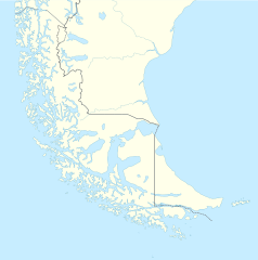
Deutsch: Positionskarte von Feuerland und Umgebung
Quadratische Plattkarte, N-S-Streckung 160 %. Geographische Begrenzung der Karte:
English: Location map of Tierra del Fuego and surroundings
Equirectangular projection, N/S stretching 160 %. Geographic limits of the map:
Español: Ubicación de Tierra del Fuego y alrededores
Proyección equirectangular, N/S 160% de estiramiento. Límites geográficos del mapa:
|
|
| তারিখ | ||
| উৎস |
নিজের কাজ, using
|
|
| লেখক | NordNordWest | |
| অনুমতি (এ ফাইলের পুনঃব্যবহার) |
এই ফাইলটি ক্রিয়েটিভ কমন্স অ্যাট্রিবিউশন-শেয়ার অ্যালাইক ৩.০ জার্মানি লাইসেন্সের আওতায় লাইসেন্সকৃত।
 এই ফাইলটি ক্রিয়েটিভ কমন্স অ্যাট্রিবিউশন-শেয়ার অ্যালাইক ৩.০ জার্মানি লাইসেন্সের আওতায় লাইসেন্সকৃত।
|
|
| অন্যান্য সংস্করণ |
এই ফাইলের উপজাত কর্মসমূহ: |

.svg)

|
এই মানচিত্রটি জার্মান Kartenwerkstatt-এ (মানচিত্র ল্যাব) উন্নতি বা তৈরি করা হয়েছে। আপনিও উন্নতি করার জন্য মানচিত্র প্রস্তাব করতে পারেন।
|
ফাইলের ইতিহাস
যেকোনো তারিখ/সময়ে ক্লিক করে দেখুন ফাইলটি তখন কী অবস্থায় ছিল।
| তারিখ/সময় | সংক্ষেপচিত্র | মাত্রা | ব্যবহারকারী | মন্তব্য | |
|---|---|---|---|---|---|
| বর্তমান | ১৬:২০, ৫ মার্চ ২০২৪ | | ১,৫৩৫ × ১,৫৫০ (৮২৪ কিলোবাইট) | Janitoalevic | More specific Beagle Channel |
| ০১:২৩, ২৯ ডিসেম্বর ২০২২ |  | ১,৫৩৫ × ১,৫৫০ (৫৮৮ কিলোবাইট) | Janitoalevic | Improved borders | |
| ১৯:৪১, ৩ মে ২০২০ |  | ১,৫৩৫ × ১,৫৫০ (৫৬৬ কিলোবাইট) | Janitoalevic | Improved Isla de los Estados | |
| ১৮:৪৭, ৩ মে ২০২০ |  | ১,৫৩৫ × ১,৫৫০ (৫৫৮ কিলোবাইট) | Janitoalevic | Improved | |
| ২৩:২৩, ২৯ আগস্ট ২০১৭ |  | ১,৫৩৫ × ১,৫৫০ (৪৪১ কিলোবাইট) | Janitoalevic | Fixed size | |
| ১১:২৩, ২৯ আগস্ট ২০১৭ |  | ১,৫৩৫ × ১,৫৫০ (৫১০ কিলোবাইট) | NordNordWest | Reverted to version as of 20:59, 15 March 2016 (UTC); change of size is catastrophic to some templates | |
| ২২:১৮, ২৮ আগস্ট ২০১৭ |  | ১,৬৩৮ × ১,৬৫৩ (৪৪২ কিলোবাইট) | Janitoalevic | More precise borders and lakes | |
| ২০:৫৯, ১৫ মার্চ ২০১৬ |  | ১,৫৩৫ × ১,৫৫০ (৫১০ কিলোবাইট) | Janitoalevic | Fixed limits following Google Earth/maps limits | |
| ২২:১২, ২ মার্চ ২০১৬ |  | ১,৫৩৫ × ১,৫৫০ (৫১০ কিলোবাইট) | Janitoalevic | Updated | |
| ২০:৩৪, ১১ সেপ্টেম্বর ২০১৫ |  | ১,৫৩৫ × ১,৫৫০ (৫০৮ কিলোবাইট) | Janitoalevic | Added Southern Patagonian Ice Field (Campo de hielo Patagónico Sur) undefined limits part, since 1998 For more information read: https://en.wikipedia.org/wiki/Southern_Patagonian_Ice_Field#Borderline Now with full resolution. |
সংযোগসমূহ
নিচের পৃষ্ঠা(গুলো) থেকে এই ছবিতে সংযোগ আছে:
ফাইলের বৈশ্বিক ব্যবহার
নিচের অন্যান্য উইকিগুলো এই ফাইলটি ব্যবহার করে:
- als.wikipedia.org-এ ব্যবহার
- ar.wikipedia.org-এ ব্যবহার
- az.wikipedia.org-এ ব্যবহার
- ba.wikipedia.org-এ ব্যবহার
- ceb.wikipedia.org-এ ব্যবহার
- cs.wikipedia.org-এ ব্যবহার
- da.wikipedia.org-এ ব্যবহার
- de.wikipedia.org-এ ব্যবহার
- el.wikipedia.org-এ ব্যবহার
- en.wikipedia.org-এ ব্যবহার
- Tierra del Fuego
- Ushuaia – Malvinas Argentinas International Airport
- Isla Grande de Tierra del Fuego
- Puerto Williams
- Río Grande, Tierra del Fuego
- Diego Ramírez Islands
- Riesco Island
- Hoste Island
- Viedma (volcano)
- Cerro Torre
- Fitz Roy
- Viedma Lake
- Gallegos River
- Mount Darwin (Andes)
- Puerto Toro
- Dawson Island
- Ildefonso Islands
- Hermite Islands
- Southern Patagonian Ice Field
- Navarino Island
- Cordillera Darwin
- Cordillera Sarmiento
- Londonderry Island
- Hornos Island
- Grey Lake
- Desolación Island
- Clarence Island, Chile
- Gordon Island
- Juan Guillermos Island
- Estancia Harberton
- Invierno mine
- Ramírez Island
এই ফাইলের অন্যান্য বৈশ্বিক ব্যবহার দেখুন।