চিত্র:LocationSingapore2.png
এর চেয়ে বেশি রেজোলিউশন লভ্য নয়।
LocationSingapore2.png (২৮০ × ১৪৮ পিক্সেল, ফাইলের আকার: ৭ কিলোবাইট, এমআইএমই ধরন: image/png)
| এই ফাইলটি উইকিমিডিয়া কমন্স থেকে নেওয়া। সেখানের বর্ণনা পাতার বিস্তারিত নিম্নে দেখানো হলো। (সম্পাদনা)
|

|
This locator map image could be re-created using vector graphics as an SVG file. This has several advantages; see Commons:Media for cleanup for more information. If an SVG form of this image is available, please upload it and afterwards replace this template with
{{vector version available|new image name}}.
It is recommended to name the SVG file “LocationSingapore2.svg”—then the template Vector version available (or Vva) does not need the new image name parameter. |
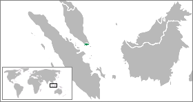
Location map for the Singapore.
Originally created for English Wikipedia by ASDFGHJ.
| |
এই কাজের প্রণেতা ASDFGHJ উইকিমিডিয়া কমন্স প্রকল্পের কাজটি পাবলিক ডোমেইনে প্রকাশ করেছেন। এটি বিশ্বব্যাপী প্রযোজ্য হবে। যে ক্ষেত্রে এটি আইনত সম্ভব নয়: |
| Annotations | This image is annotated: View the annotations at Commons |
ফাইলের ইতিহাস
যেকোনো তারিখ/সময়ে ক্লিক করে দেখুন ফাইলটি তখন কী অবস্থায় ছিল।
| তারিখ/সময় | সংক্ষেপচিত্র | মাত্রা | ব্যবহারকারী | মন্তব্য | |
|---|---|---|---|---|---|
| বর্তমান | ০৭:৫১, ১১ মার্চ ২০০৯ | | ২৮০ × ১৪৮ (৭ কিলোবাইট) | ASDFGHJ | Location map for the Singapore.<br/>Originally created for English Wikipedia by ASDFGHJ. {{PD-user-w|en|English Wikipedia|ASDFGHJ}} {{svg|map}} Category:Locator maps of countries <!--{{ImageUpload|basic}}--> |
সংযোগসমূহ
নিচের পৃষ্ঠা(গুলো) থেকে এই ছবিতে সংযোগ আছে:
ফাইলের বৈশ্বিক ব্যবহার
নিচের অন্যান্য উইকিগুলো এই ফাইলটি ব্যবহার করে:
- ace.wikipedia.org-এ ব্যবহার
- ar.wikipedia.org-এ ব্যবহার
- awa.wikipedia.org-এ ব্যবহার
- ban.wikipedia.org-এ ব্যবহার
- be.wikipedia.org-এ ব্যবহার
- ceb.wikipedia.org-এ ব্যবহার
- dv.wikipedia.org-এ ব্যবহার
- en.wikipedia.org-এ ব্যবহার
- fiu-vro.wikipedia.org-এ ব্যবহার
- fr.wikipedia.org-এ ব্যবহার
- gor.wikipedia.org-এ ব্যবহার
- gv.wikipedia.org-এ ব্যবহার
- id.wikipedia.org-এ ব্যবহার
- incubator.wikimedia.org-এ ব্যবহার
- Wn/ms/Wajah terbaru Taman Warisan Melayu
- Template:Wn/ms/Singapura
- Wn/ms/Syarikat telekomunikasi SingTel didenda
- Wn/ms/Singapura bubar parlimen, pilihanraya 10 Julai
- Wn/ms/PRU Singapura 2020: PAP menang selesa, WP tambah 4 kerusi
- Wn/ms/Lawrence Wong bakal dilantik sebagai Perdana Menteri Singapura baharu pada 15 Mei
- Wn/ms/Gan Kim Yong dilantik sebagai Timbalan Perdana Menteri Singapura dalam rombakan kabinet terbaru
- ja.wikipedia.org-এ ব্যবহার
- ka.wikipedia.org-এ ব্যবহার
- mk.wikipedia.org-এ ব্যবহার
- mr.wikipedia.org-এ ব্যবহার
- ms.wikipedia.org-এ ব্যবহার
- new.wikipedia.org-এ ব্যবহার
- pl.wikipedia.org-এ ব্যবহার
- ru.wikipedia.org-এ ব্যবহার
- ru.wikinews.org-এ ব্যবহার
- simple.wiktionary.org-এ ব্যবহার
- tet.wikipedia.org-এ ব্যবহার
- tum.wikipedia.org-এ ব্যবহার
- uk.wikipedia.org-এ ব্যবহার
- vi.wikipedia.org-এ ব্যবহার
- yo.wikipedia.org-এ ব্যবহার