চিত্র:European location legend en.svg

এই SVG ফাইলের জন্য এই PNG প্রাকদর্শনের আকার: ৫০৩ × ৩১৬ পিক্সেল। অন্যান্য আকারসমূহ: ৩২০ × ২০১ পিক্সেল | ৬৪০ × ৪০২ পিক্সেল | ১,০২৪ × ৬৪৩ পিক্সেল | ১,২৮০ × ৮০৪ পিক্সেল | ২,৫৬০ × ১,৬০৮ পিক্সেল।
পূর্ণ রেজোলিউশন (এসভিজি ফাইল, সাধারণত ৫০৩ × ৩১৬ পিক্সেল, ফাইলের আকার: ১০ কিলোবাইট)
| এই ফাইলটি উইকিমিডিয়া কমন্স থেকে নেওয়া। সেখানের বর্ণনা পাতার বিস্তারিত নিম্নে দেখানো হলো। (সম্পাদনা)
|
| বিবরণ |
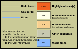
English: English only: Map legend to the series "Europe location / EU location". At the English-language Wikipedia the image filename is intended to be passed as a parameter to template 'Map caption' wich writes a link, itself intended to be passed to template 'Infobox Countries', in particular for articles on European countries. |
||
| তারিখ | |||
| উৎস |
own work after User:SomeHuman's Image:European location legend en.png (text modifications, colour determination according to actual David Liuzzo maps, redesigning and creation of image) based on Image:EU location legend.png by David Liuzzo This file is an extension to the "EU location" map series created by David Liuzzo {|cellspacing="0" cellpadding="0" border="1" style="font-size:12px;background-color:#cccc99;border-collapse:collapse;border:6px solid #000000;"
|style="padding:0px;border:0px none;background-color:#cccc99;"|
{|cellspacing="0" cellpadding="0" border="0" style="margin-left:9px;margin-top:9px;margin-bottom:11px;background-color:#cccc99;border:0px none;"
|
{|cellspacing="0" cellpadding="0" border="0" style="margin-top:9px;margin-bottom:9px;background-color:#cccc99;border:0px none;"
|"height="3" style="background-color:#505048;border-top:0px solid #edbf94;border-bottom:0px solid #edbf94;font-size:2px;line-height:2px;height:3px;width:112px;vertical-align:middle;color:#505048;"|r
|-
|style="height:34px;font-size:1px;line-height:1px;visibility:hidden;"|r
|-
|height="3" style="background-color:#a0a090;border-top:0px solid #edbf94;border-bottom:0px solid #edbf94;font-size:2px;line-height:2px;height:3px;width:112px;vertical-align:middle;color:#a0a090;"|r
|-
|style="height:34px;font-size:1px;line-height:1px;visibility:hidden;"|r
|-
|height="3" style="background-color:#88b8ff;border-top:0px solid #edbf94;border-bottom:0px solid #edbf94;font-size:2px;line-height:2px;height:3px;width:112px;vertical-align:middle;color:#88b8ff;"|r
|}
|
{|cellspacing="0" cellpadding="0" border="0" style="margin-left:9px;margin-top:9px;margin-bottom:9px;background-color:#cccc99;border:0px none;"
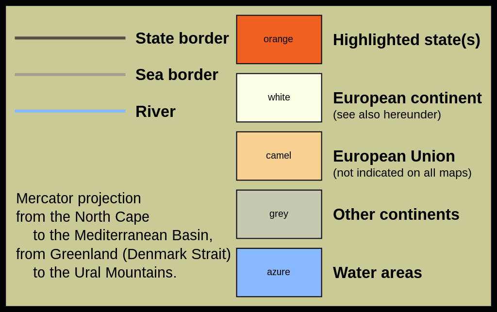
|<span style="font-family:Arial;font-size:16px;line-height:16px;font-weight:800;">State border</span>
|-
|style="height:22px;font-size:1px;line-height:1px;visibility:hidden;"|r
|-
|<span style="font-family:Arial;font-size:16px;line-height:16px;font-weight:800;">Sea border</span>
|-
|style="height:22px;font-size:1px;line-height:1px;visibility:hidden;"|r
|-
|<span style="font-family:Arial;font-size:16px;line-height:16px;font-weight:800;">River</span>
|}
|-
|colspan="2" style="height:57px;font-size:1px;line-height:1px;visibility:hidden;"|r
|-
|colspan="2" style="padding-left:0px;padding-right:0px;padding-bottom:4px;qcolor:#ffffff;font-family:Arial;font-size:15px;font-weight:400;"|Mercator projection<br />from the North Cape<br /><span style="visibility:hidden;">fro</span>to the Mediterranean Basin,<br />from Greenland (Denmark Strait)<br /><span style="visibility:hidden;">fro</span>to the Ural Mountains.</span>
|}
|style="border:0px none;"|
{|cellspacing="9" border="0" style="background-color:#cccc99;"
|style="background-color:#f06020;border:1px solid #000000;font-size:10px;width:83px;text-align:center;vertical-align:middle;"|orange||style="line-height:1.35em;"|<br/><span style="font-family:Arial;font-size:16px;font-weight:800;">Highlighted state(s)</span><br/><br />
|-
|style="background-color:#ffffe8;border:1px solid #000000;font-size:10px;width:83px;text-align:center;vertical-align:middle;"|white||style="line-height:1.35em;"|<br /><span style="font-family:Arial;font-size:16px;font-weight:800;">European continent</span><br/><span style="font-family:Arial;font-size:12px;font-weight:500;">(see also hereunder)</span>
|-
|style="background-color:#f8d090;border:1px solid #000000;font-size:10px;width:83px;text-align:center;vertical-align:middle;"|camel<!--sandybrown,topaz-websafecolor=ffcc99-->||style="line-height:1.35em;"|<br /><span style="font-family:Arial;font-size:16px;font-weight:800;">European Union</span><br/><span style="font-family:Arial;font-size:12px;font-weight:500;">(not indicated on all maps)
|-
|style="background-color:#c8c8b0;border:1px solid #000000;font-size:10px;width:83px;text-align:center;vertical-align:middle;"|grey||style="line-height:1.35em;"|<br /><span style="font-family:Arial;font-size:16px;font-weight:800;">Other continents</span><br /><br />
|-
|style="background-color:#88b8ff;border:1px solid #000000;font-size:10px;width:83px;text-align:center;vertical-align:middle;"|azure||style="line-height:1.35em;"|<br /><span style="font-family:Arial;font-size:16px;font-weight:800;">Water areas</span><br /><br />
|}
|} |
||
| লেখক | Alex Khristov | ||
| অনুমতি (এ ফাইলের পুনঃব্যবহার) |
|
ফাইলের ইতিহাস
যেকোনো তারিখ/সময়ে ক্লিক করে দেখুন ফাইলটি তখন কী অবস্থায় ছিল।
| তারিখ/সময় | সংক্ষেপচিত্র | মাত্রা | ব্যবহারকারী | মন্তব্য | |
|---|---|---|---|---|---|
| বর্তমান | ১০:২৬, ২৮ এপ্রিল ২০০৭ | | ৫০৩ × ৩১৬ (১০ কিলোবাইট) | Akhristov | fix |
| ১০:১৯, ২৮ এপ্রিল ২০০৭ |  | ৫০৩ × ৩১৬ (১০ কিলোবাইট) | Akhristov | {{Information |Description={{en|English only: Map legend to the series "Europe location / EU location".<br />At the English-language Wikipedia the image filename is intended to be passed as a parameter to template 'Map caption'<br />wich writes a link, it |
সংযোগসমূহ
এই ফাইল ব্যবহার করে এমন কোনো পাতা নেই।