চিত্র:1805 cary.jpg
এই প্রাকদর্শনের আকার: ৬৬৯ × ৬০০ পিক্সেল। অন্যান্য আকারসমূহ: ২৬৮ × ২৪০ পিক্সেল | ৫৩৬ × ৪৮০ পিক্সেল | ৮৫৭ × ৭৬৮ পিক্সেল | ১,১৪২ × ১,০২৪ পিক্সেল | ২,১৬৩ × ১,৯৩৯ পিক্সেল।
পূর্ণ রেজোলিউশন (২,১৬৩ × ১,৯৩৯ পিক্সেল, ফাইলের আকার: ৫.০৮ মেগাবাইট, এমআইএমই ধরন: image/jpeg)
| এই ফাইলটি উইকিমিডিয়া কমন্স থেকে নেওয়া। সেখানের বর্ণনা পাতার বিস্তারিত নিম্নে দেখানো হলো। (সম্পাদনা)
|
সারাংশ
| বিবরণ |
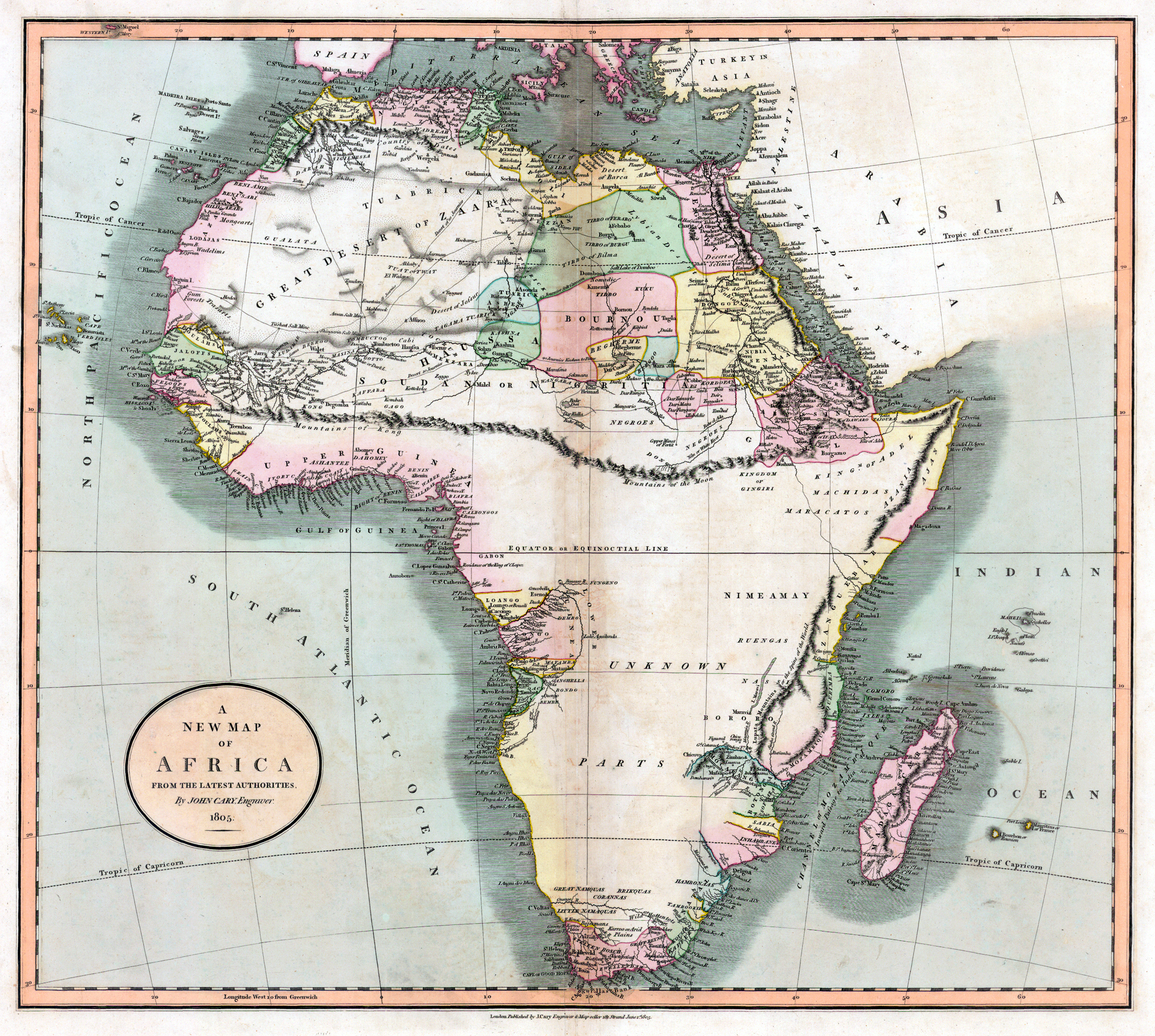
Deutsch: Alte Landkarte von Afrika. Die fiktiven "Kong-Berge" sind eingezeichnet.
English: Old map from Africa, made by John Cary in 1805. The map shows the non exisiting "Mountains of Kong". |
|||||||||||||||||||||||||
| তারিখ | ||||||||||||||||||||||||||
| উৎস | http://libweb5.princeton.edu/visual_materials/maps/websites/africa/maps-central/central.html | |||||||||||||||||||||||||
| লেখক |
|
|||||||||||||||||||||||||
| অন্যান্য সংস্করণ |
 |
|||||||||||||||||||||||||
লাইসেন্স প্রদান
|
This is a faithful photographic reproduction of a two-dimensional, public domain work of art. The work of art itself is in the public domain for the following reason:
The official position taken by the Wikimedia Foundation is that "faithful reproductions of two-dimensional public domain works of art are public domain".
This photographic reproduction is therefore also considered to be in the public domain in the United States. In other jurisdictions, re-use of this content may be restricted; see Reuse of PD-Art photographs for details. | ||||
ফাইলের ইতিহাস
যেকোনো তারিখ/সময়ে ক্লিক করে দেখুন ফাইলটি তখন কী অবস্থায় ছিল।
| তারিখ/সময় | সংক্ষেপচিত্র | মাত্রা | ব্যবহারকারী | মন্তব্য | |
|---|---|---|---|---|---|
| বর্তমান | ১৩:০২, ২১ জুন ২০০৯ | | ২,১৬৩ × ১,৯৩৯ (৫.০৮ মেগাবাইট) | Kuebi | {{Information |Description= {{de|Alte Landkarte von Afrika von John Cary aus dem Jahr 1805. Die fiktiven "Kong-Berge" sind eingezeichnet.}} {{en|Old map from Africa, made by John Cary in 1805. The map shows the non exisiting "Mountains of Kong".}} |Source |
সংযোগসমূহ
নিচের পৃষ্ঠা(গুলো) থেকে এই ছবিতে সংযোগ আছে:
ফাইলের বৈশ্বিক ব্যবহার
নিচের অন্যান্য উইকিগুলো এই ফাইলটি ব্যবহার করে:
- ast.wikipedia.org-এ ব্যবহার
- da.wikipedia.org-এ ব্যবহার
- de.wikipedia.org-এ ব্যবহার
- en.wikipedia.org-এ ব্যবহার
- es.wikipedia.org-এ ব্যবহার
- fr.wikipedia.org-এ ব্যবহার
- it.wikipedia.org-এ ব্যবহার
- ja.wikipedia.org-এ ব্যবহার
- mk.wikipedia.org-এ ব্যবহার
- pl.wikipedia.org-এ ব্যবহার
- pt.wikipedia.org-এ ব্যবহার
- vi.wikipedia.org-এ ব্যবহার
- www.wikidata.org-এ ব্যবহার