চিত্র:XXth Century Citizen's Atlas map of Central Asia.png
এই প্রাকদর্শনের আকার: ৮০০ × ৫৬৬ পিক্সেল। অন্যান্য আকারসমূহ: ৩২০ × ২২৭ পিক্সেল | ৬৪০ × ৪৫৩ পিক্সেল | ১,০২৪ × ৭২৫ পিক্সেল | ১,২৮০ × ৯০৬ পিক্সেল | ২,৫৪৮ × ১,৮০৪ পিক্সেল।
পূর্ণ রেজোলিউশন (২,৫৪৮ × ১,৮০৪ পিক্সেল, ফাইলের আকার: ৭.৪৯ মেগাবাইট, এমআইএমই ধরন: image/png)
| এই ফাইলটি উইকিমিডিয়া কমন্স থেকে নেওয়া। সেখানের বর্ণনা পাতার বিস্তারিত নিম্নে দেখানো হলো। (সম্পাদনা)
|
| বিবরণ | |
| তারিখ | |
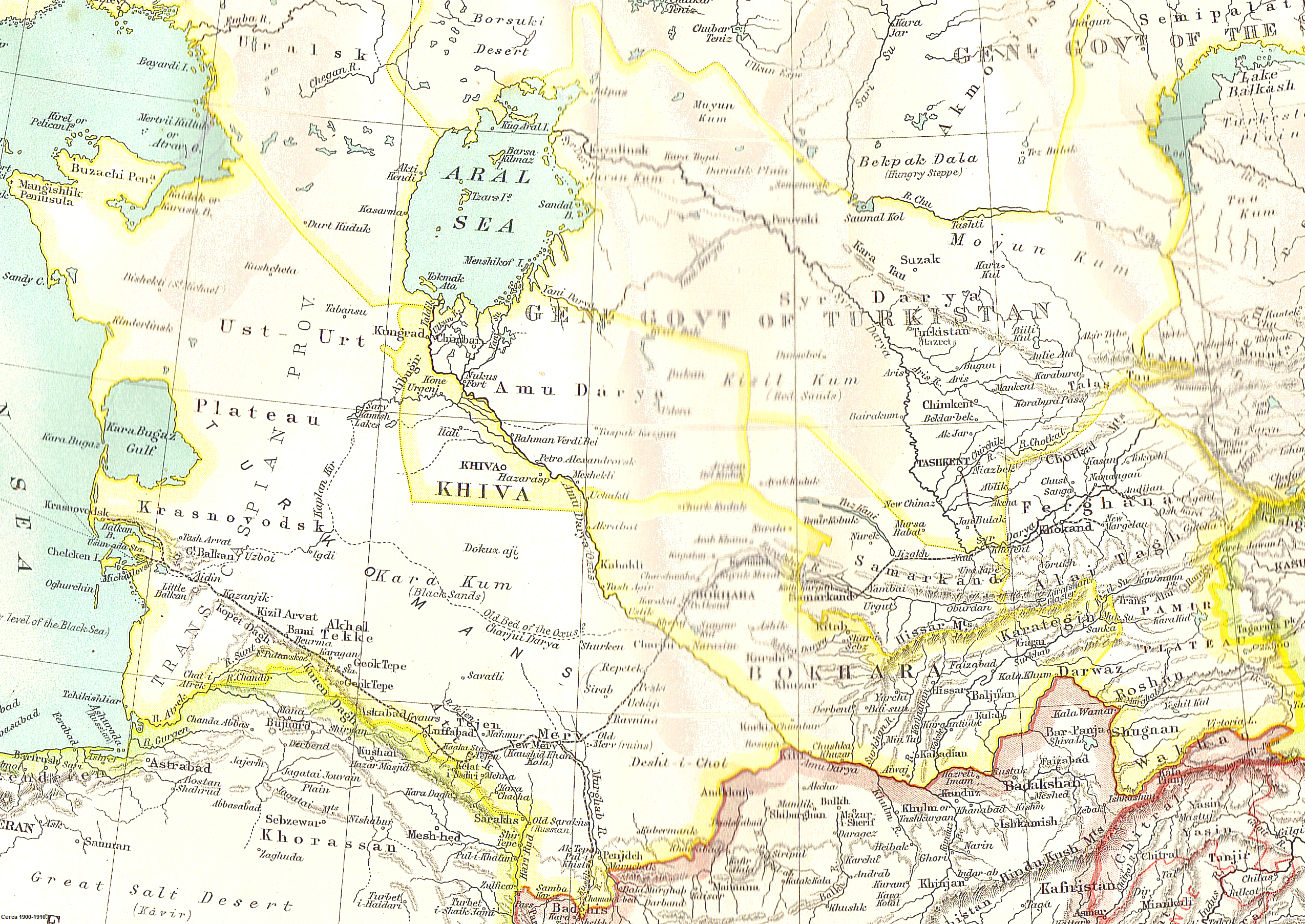
| উৎস | Scanned from John Bartholomew's XXth Century Citizen's Atlas (1903) |
| লেখক | Uncertain: either John George Bartholomew or an unknown employee |
| অনুমতি (এ ফাইলের পুনঃব্যবহার) |
If this were produced by Bartholomew himself, it is {{PD-UK-known}}, because Bartholomew died in 1920. If it were produced by an anonymous employee, it is {{PD-UK-unknown}}, because it is an anonymous artistic work other than a photograph, which was made available to the public before 1 January 1940. Either way, it is public domain in the United Kingdom, the country of origin. Published before 1923, it is also public domain in the United States. |
This media file is in the public domain in the United States. This applies to U.S. works where the copyright has expired, often because its first publication occurred prior to January 1, 1929, and if not then due to lack of notice or renewal. See this page for further explanation.
|
 | |
 |
This image might not be in the public domain outside of the United States; this especially applies in the countries and areas that do not apply the rule of the shorter term for US works, such as Canada, Mainland China (not Hong Kong or Macao), Germany, Mexico, and Switzerland. The creator and year of publication are essential information and must be provided. See Wikipedia:Public domain and Wikipedia:Copyrights for more details.
|
ফাইলের ইতিহাস
যেকোনো তারিখ/সময়ে ক্লিক করে দেখুন ফাইলটি তখন কী অবস্থায় ছিল।
| তারিখ/সময় | সংক্ষেপচিত্র | মাত্রা | ব্যবহারকারী | মন্তব্য | |
|---|---|---|---|---|---|
| বর্তমান | ১২:১৮, ৬ মে ২০১০ | | ২,৫৪৮ × ১,৮০৪ (৭.৪৯ মেগাবাইট) | Nyttend | {{Information |Description = A map of Central Asia |Source = Scanned from [http://catalogue.nla.gov.au/Record/2532586 John Bartholomew's ''XXth Century Citizen's Atlas'' (1903)] |Date = 1903 |Author = Uncertain: either John George Bartholomew or an un |
সংযোগসমূহ
নিচের পৃষ্ঠা(গুলো) থেকে এই ছবিতে সংযোগ আছে:
ফাইলের বৈশ্বিক ব্যবহার
নিচের অন্যান্য উইকিগুলো এই ফাইলটি ব্যবহার করে:
- ar.wikipedia.org-এ ব্যবহার
- azb.wikipedia.org-এ ব্যবহার
- bg.wikipedia.org-এ ব্যবহার
- da.wikipedia.org-এ ব্যবহার
- de.wikipedia.org-এ ব্যবহার
- el.wikipedia.org-এ ব্যবহার
- en.wikipedia.org-এ ব্যবহার
- Khwarazm
- Russian Turkestan
- Khanate of Kokand
- Khanate of Khiva
- Soviet Central Asia
- User:John Q. A. Geadon
- Uzboy
- Arys (river)
- User talk:Snow storm in Eastern Asia/Archive pictures 2
- User talk:Its snowing in East Asia/Archive pictures 0
- User talk:Its snowing in East Asia/Archive pictures 1
- User talk:Its snowing in East Asia/Archive pictures 2
- Foreign policy of the Russian Empire
- User:Falcaorib
- es.wikipedia.org-এ ব্যবহার
- et.wikipedia.org-এ ব্যবহার
- fa.wikipedia.org-এ ব্যবহার
- fi.wikipedia.org-এ ব্যবহার
- he.wikipedia.org-এ ব্যবহার
- it.wikipedia.org-এ ব্যবহার
- ka.wikipedia.org-এ ব্যবহার
- kk.wikipedia.org-এ ব্যবহার
- ko.wikipedia.org-এ ব্যবহার
- lv.wikipedia.org-এ ব্যবহার
- nl.wikipedia.org-এ ব্যবহার
- no.wikipedia.org-এ ব্যবহার
- pa.wikipedia.org-এ ব্যবহার
এই ফাইলের অন্যান্য বৈশ্বিক ব্যবহার দেখুন।