চিত্র:Romania 1956-1990.svg

এই SVG ফাইলের জন্য এই PNG প্রাকদর্শনের আকার: ৪৫০ × ৪৫৬ পিক্সেল। অন্যান্য আকারসমূহ: ২৩৭ × ২৪০ পিক্সেল | ৪৭৪ × ৪৮০ পিক্সেল | ৭৫৮ × ৭৬৮ পিক্সেল | ১,০১১ × ১,০২৪ পিক্সেল | ২,০২১ × ২,০৪৮ পিক্সেল।
পূর্ণ রেজোলিউশন (এসভিজি ফাইল, সাধারণত ৪৫০ × ৪৫৬ পিক্সেল, ফাইলের আকার: ৪৭৫ কিলোবাইট)
| এই ফাইলটি উইকিমিডিয়া কমন্স থেকে নেওয়া। সেখানের বর্ণনা পাতার বিস্তারিত নিম্নে দেখানো হলো। (সম্পাদনা)
|
সারাংশ


.svg)
.svg)
.svg)
.svg)
.svg)


.svg)
.svg)
.svg)


.png)
.png)


.svg)


.svg)

.svg)


.svg)
.svg)
.svg)
.svg)


.svg)
.png)


.svg)


.svg)
.svg)


.svg)


.svg)


.svg)
.svg)
.svg)
.svg)
.svg)
.svg)
.svg)
_cropped.svg)
.svg)
.svg)
.svg)
.svg)
.svg)
.svg)
.svg)
.svg)
.svg)
.svg)
.svg)
.svg)
.svg)
.svg)
.svg)
.svg)
.svg)
.svg)
.svg)
.svg)
.svg)
.svg)
.svg)
.svg)
.svg)
.svg)
.svg)
.svg)
.svg)
.svg)
.svg)
.svg)
.svg)
.svg)
.svg)
.svg)
.svg)
.svg)
.svg)
.svg)
.svg)
.svg)
.svg)
.svg)
.svg)
| এটি একটি পুনঃসম্পাদিত চিত্র, যার মানে হল যে এটি ডিজিটালরূপে এটির মূল সংস্করণ থেকে পরিবর্তন করা হয়েছে। আসলটি দেখা যাবে এখানে: Blank map of Europe 1956-1990.svg।
|
লাইসেন্স প্রদান
আমি, এই কাজের স্বত্বাধিকারী, এতদ্দ্বারা আমি এই কাজকে নিম্ন বর্ণিত লাইসেন্সের আওতায় প্রকাশ করলাম:
এই ফাইলটি ক্রিয়েটিভ কমন্স অ্যাট্রিবিউশন-শেয়ার অ্যালাইক ৩.০ আনপোর্টেড লাইসেন্সের আওতায় লাইসেন্সকৃত।
- আপনি স্বাধীনভাবে:
- বণ্টন করতে পারেন – এ কাজটি অনুলিপি, বিতরণ এবং প্রেরণ করতে পারেন
- পুনঃমিশ্রণ করতে পারেন – কাজটি অভিযোজন করতে পারেন
- নিম্নের শর্তাবলীর ভিত্তিতে:
- স্বীকৃতিপ্রদান – আপনাকে অবশ্যই যথাযথ স্বীকৃতি প্রদান করতে হবে, লাইসেন্সের একটি লিঙ্ক সরবরাহ করতে হবে এবং কোনো পরিবর্তন হয়েছে কিনা তা নির্দেশ করতে হবে। আপনি যেকোনো যুক্তিসঙ্গত পদ্ধতিতে এটি করতে পারেন। কিন্তু এমন ভাবে নয়, যাতে প্রকাশ পায় যে লাইসেন্সধারী আপনাকে বা আপনার এই ব্যবহারের জন্য অনুমোদন দিয়েছে।
- একইভাবে বণ্টন – আপনি যদি কাজটি পুনঃমিশ্রণ, রুপান্তর, বা এর ওপর ভিত্তি করে নতুন সৃষ্টিকর্ম তৈরি করেন, তবে আপনাকে অবশ্যই আপনার অবদান একই লাইসেন্স বা একই রকমের লাইসেন্সের আওতায় বিতরণ করতে হবে।
মূল আপলোড লগ
This image is a derivative work of the following images:
- File:Blank_map_of_Europe_1956-1990.svg licensed with Cc-by-sa-3.0
- 2011-10-30T04:43:42Z Alphathon 450x456 (485146 Bytes) == {{int:filedesc}} == {{Information |Description={{en|Blank map of Europe showing national borders as they stood from 1956-1990.}} |Source=*[[:File:Blank_map_of_Europe.svg|]] |Date=2011-10-30 04:42 (UTC) |Author=*[[:File:Bla
ফাইলের ইতিহাস
যেকোনো তারিখ/সময়ে ক্লিক করে দেখুন ফাইলটি তখন কী অবস্থায় ছিল।
| তারিখ/সময় | সংক্ষেপচিত্র | মাত্রা | ব্যবহারকারী | মন্তব্য | |
|---|---|---|---|---|---|
| বর্তমান | ১৮:০৬, ৩০ অক্টোবর ২০২৩ | | ৪৫০ × ৪৫৬ (৪৭৫ কিলোবাইট) | Rgvis | Ceausescu demanded the cancellation of all agreements concluded during the Second World War with Nazi Germany, but without any modification of the borders: [https://www.mediafax.ro/revolutie-30/revolutions-la-congresul-al-xiv-lea-al-pcr-ceausescu-a-cerut-anularea-pactului-ribbentrop-molotov-partea-a-iii-a-18602951] |
| ১৭:০১, ২ মে ২০২৩ |  | ৪৫০ × ৪৫৬ (৪৮০ কিলোবাইট) | Glide08 | Reverted to version as of 17:25, 30 September 2022 (UTC) for a brief period between the 14 Congress of the PCR and the downfall of Ceausescu's regime, they did. The 14th congress of the PCR passed a resolution that demanded the annulment of the Molotov-Ribbentrop pact (which meant ceding Bessarabia back to Romania) | |
| ১৮:২২, ১ মে ২০২৩ |  | ৪৫০ × ৪৫৬ (৪৭৫ কিলোবাইট) | Trecătorul răcit | The areas annexed by USSR (1940) were NOT claimed by the communist Romania during its existence (nor after).. | |
| ১৭:২৫, ৩০ সেপ্টেম্বর ২০২২ |  | ৪৫০ × ৪৫৬ (৪৮০ কিলোবাইট) | Glide08 | Added a mark for Bessarabia dn Northern Bukovina, claimed by Romania between the 14th Congress of the PCR and the Revolution | |
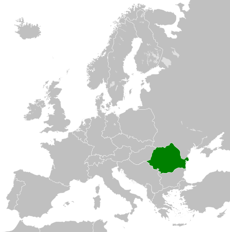
| ০০:৪৬, ২৬ নভেম্বর ২০১১ |  | ৪৫০ × ৪৫৬ (৪৭৫ কিলোবাইট) | StalwartUK | == {{int:filedesc}} == {{Information |Description={{en|Map of Communist Romania (Romanian People's Republic/Socialist Republic of Romania) as it was from 1947-1989. Surrounding countries accurate from 1956-1990.}} |Source=*[[:Fil |
সংযোগসমূহ
নিচের পৃষ্ঠা(গুলো) থেকে এই ছবিতে সংযোগ আছে:
ফাইলের বৈশ্বিক ব্যবহার
নিচের অন্যান্য উইকিগুলো এই ফাইলটি ব্যবহার করে:
- als.wikipedia.org-এ ব্যবহার
- ast.wikipedia.org-এ ব্যবহার
- azb.wikipedia.org-এ ব্যবহার
- az.wikipedia.org-এ ব্যবহার
- be.wikipedia.org-এ ব্যবহার
- bg.wikipedia.org-এ ব্যবহার
- ca.wikipedia.org-এ ব্যবহার
- cs.wikipedia.org-এ ব্যবহার
- cs.wikiquote.org-এ ব্যবহার
- de.wikipedia.org-এ ব্যবহার
- en.wikipedia.org-এ ব্যবহার
- en.wikiquote.org-এ ব্যবহার
- eo.wikipedia.org-এ ব্যবহার
- es.wikipedia.org-এ ব্যবহার
- et.wikipedia.org-এ ব্যবহার
- fa.wikipedia.org-এ ব্যবহার
- fi.wikipedia.org-এ ব্যবহার
- fr.wikipedia.org-এ ব্যবহার
- gl.wikipedia.org-এ ব্যবহার
- he.wikipedia.org-এ ব্যবহার
- id.wikipedia.org-এ ব্যবহার
- it.wikipedia.org-এ ব্যবহার
- ja.wikipedia.org-এ ব্যবহার
- ko.wikipedia.org-এ ব্যবহার
- lt.wikipedia.org-এ ব্যবহার
- lv.wikipedia.org-এ ব্যবহার
- nl.wikipedia.org-এ ব্যবহার
- os.wikipedia.org-এ ব্যবহার
- pnb.wikipedia.org-এ ব্যবহার
- pt.wikipedia.org-এ ব্যবহার
- ro.wikipedia.org-এ ব্যবহার
- rue.wikipedia.org-এ ব্যবহার
- ru.wikipedia.org-এ ব্যবহার
- sc.wikipedia.org-এ ব্যবহার
- simple.wikipedia.org-এ ব্যবহার
- sk.wikipedia.org-এ ব্যবহার
- sq.wikipedia.org-এ ব্যবহার
- sr.wikipedia.org-এ ব্যবহার
এই ফাইলের অন্যান্য বৈশ্বিক ব্যবহার দেখুন।