চিত্র:Map indicating Hudson Strait, Nunavut, Canada.png
এর চেয়ে বেশি রেজোলিউশন লভ্য নয়।
Map_indicating_Hudson_Strait,_Nunavut,_Canada.png (৪১০ × ৩৭০ পিক্সেল, ফাইলের আকার: ৫২ কিলোবাইট, এমআইএমই ধরন: image/png)
| এই ফাইলটি উইকিমিডিয়া কমন্স থেকে নেওয়া। সেখানের বর্ণনা পাতার বিস্তারিত নিম্নে দেখানো হলো। (সম্পাদনা)
|
সারাংশ
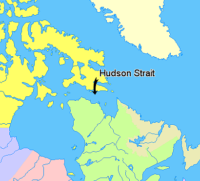
Map indicating Hudson Strait, Nunavut, Canada.
Nunavut
Greenland
Quebec
Newfoundland and Labrador
Manitoba
Ontario
© Her Majesty the Queen in Right of Canada, Department of Natural Resources. All rights reserved.
Licence Agreement
লাইসেন্স প্রদান

|
The copyright holder of this work allows anyone to use it for any purpose including unrestricted redistribution, commercial use, and modification.
Usage notes:
|
ফাইলের ইতিহাস
যেকোনো তারিখ/সময়ে ক্লিক করে দেখুন ফাইলটি তখন কী অবস্থায় ছিল।
| তারিখ/সময় | সংক্ষেপচিত্র | মাত্রা | ব্যবহারকারী | মন্তব্য | |
|---|---|---|---|---|---|
| বর্তমান | ১৩:৫৫, ২১ মার্চ ২০০৬ | | ৪১০ × ৩৭০ (৫২ কিলোবাইট) | David Kernow~commonswiki | == Summary == Map indicating Hudson Strait, Nunavut, Canada. {{legend|#ffff66|Nunavut}} {{legend|#ffffcc|Greenland}} {{legend|#d5fe94|Quebec}} {{legend|#ecebb6|Newfoundland and Labrador}} {{legend|#ccccff|Manitoba}} {{legend|#ffcccc|O |
সংযোগসমূহ
নিচের পৃষ্ঠা(গুলো) থেকে এই ছবিতে সংযোগ আছে:
ফাইলের বৈশ্বিক ব্যবহার
নিচের অন্যান্য উইকিগুলো এই ফাইলটি ব্যবহার করে:
- ar.wikipedia.org-এ ব্যবহার
- az.wikipedia.org-এ ব্যবহার
- ba.wikipedia.org-এ ব্যবহার
- bg.wikipedia.org-এ ব্যবহার
- ca.wikipedia.org-এ ব্যবহার
- cs.wikipedia.org-এ ব্যবহার
- da.wikipedia.org-এ ব্যবহার
- de.wikipedia.org-এ ব্যবহার
- en.wikipedia.org-এ ব্যবহার
- eo.wikipedia.org-এ ব্যবহার
- eu.wikipedia.org-এ ব্যবহার
- fa.wikipedia.org-এ ব্যবহার
- fi.wikipedia.org-এ ব্যবহার
- fr.wikipedia.org-এ ব্যবহার
- gl.wikipedia.org-এ ব্যবহার
- he.wikipedia.org-এ ব্যবহার
- hr.wikipedia.org-এ ব্যবহার
- id.wikipedia.org-এ ব্যবহার
- it.wikipedia.org-এ ব্যবহার
- ka.wikipedia.org-এ ব্যবহার
- la.wikipedia.org-এ ব্যবহার
- li.wikipedia.org-এ ব্যবহার
- lt.wikipedia.org-এ ব্যবহার
- mhr.wikipedia.org-এ ব্যবহার
- ml.wikipedia.org-এ ব্যবহার
- nl.wikipedia.org-এ ব্যবহার
- nn.wikipedia.org-এ ব্যবহার
- no.wikipedia.org-এ ব্যবহার
- pl.wikipedia.org-এ ব্যবহার
- pt.wikipedia.org-এ ব্যবহার
- ru.wikipedia.org-এ ব্যবহার
- simple.wikipedia.org-এ ব্যবহার
- sk.wikipedia.org-এ ব্যবহার
- sl.wikipedia.org-এ ব্যবহার
- sr.wikipedia.org-এ ব্যবহার
- sv.wikipedia.org-এ ব্যবহার
- sw.wikipedia.org-এ ব্যবহার
- uz.wikipedia.org-এ ব্যবহার
- vi.wikipedia.org-এ ব্যবহার
- war.wikipedia.org-এ ব্যবহার