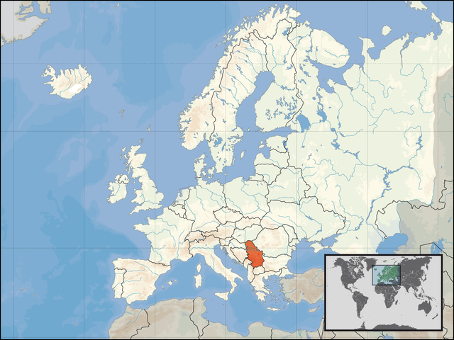
চিত্র:Location of Serbia in Europe, Kosovo included.png

এই প্রাকদর্শনের আকার: ৮০০ × ৬০০ পিক্সেল। অন্যান্য আকারসমূহ: ৩২০ × ২৪০ পিক্সেল | ৬৪০ × ৪৮০ পিক্সেল | ১,০২৪ × ৭৬৮ পিক্সেল | ১,২৮০ × ৯৬০ পিক্সেল | ১,৬০০ × ১,২০০ পিক্সেল।
পূর্ণ রেজোলিউশন (১,৬০০ × ১,২০০ পিক্সেল, ফাইলের আকার: ৭১১ কিলোবাইট, এমআইএমই ধরন: image/png)
| এই ফাইলটি উইকিমিডিয়া কমন্স থেকে নেওয়া। সেখানের বর্ণনা পাতার বিস্তারিত নিম্নে দেখানো হলো। (সম্পাদনা)
|
| বিবরণ | ||||
| তারিখ | ||||
| উৎস | নিজের কাজ | |||
| লেখক | User:David Liuzzo | |||
| অনুমতি (এ ফাইলের পুনঃব্যবহার) |
|

File history
| date/time | username | resolution | size | edit summary |
|---|---|---|---|---|
| 21:14, 6 July 2008 | User:Samulili | 1,600×1,200 | 711 KB | Original version, you may upload other versions with a different name |
| 04:55, 5 July 2008 | User:Wengier | 800×600 | 486 KB | Revert; you can also argue Taiwan is China, according to UNSC and LARGE majority of world countries |
| 14:33, 4 July 2008 | User:Bože pravde | 1,600×1,200 | 711 KB | Reverted to version as of 06:51, 29 June 2008 - Kosovo is Serbia, according to UNSC and LARGE majority of world countries |
| 07:10, 29 June 2008 | User:Wengier | 800×600 | 486 KB | Nice point. Removed border. Happy now? |
| 06:51, 29 June 2008 | User:Tocino | 1,600×1,200 | 711 KB | reverted.... Serbia claims Kosovo as part of its territory and there should be no border between central Serbia and Kosovo on this map for Serbia |
| 03:59, 29 June 2008 | User:Wengier | 800×600 | 486 KB | It's not original at all, but a Wikipedia policy. Please read the talk page of Serbia! |
| 03:26, 29 June 2008 | User:Bogdan K | 1,600×1,200 | 711 KB | Good argument, very original |
| 02:14, 29 June 2008 | User:Wengier | 800×600 | 486 KB | Stop just push your one-side opinion! This is Wikipedia, please keep it NPOV |
| 02:01, 29 June 2008 | User:Bogdan K | 1,600×1,200 | 711 KB | Stop comparing apples and oranges--was Taiwan ever under UN administration? Does Kosovo have a government in exile? |
| 01:35, 29 June 2008 | User:Wengier | 800×600 | 486 KB | Taiwan (ROC) is recognized by 23 countries, but Kosovo is recognized by more. |
| 01:33, 29 June 2008 | User:Bogdan K | 1,600×1,200 | 711 KB | Alright, so wait 50 years and then upload it in a different colour |
| 01:22, 29 June 2008 | User:Wengier | 800×600 | 486 KB | Stop push towards POV! China also claims Taiwan as an integral part of China, but it's shown in a different color! |
| 01:09, 29 June 2008 | User:Tocino | 1,600×1,200 | 711 KB | Please stop changing this. Serbia includes Kosovo as part of its territory and this map is for the Serbia article. |
| 21:30, 27 June 2008 | User:Wengier | 800×600 | 486 KB | {{Information |Description=Use different color instead of shading, just like China map |Source=based on original version |Date= |Author= |Permission= |other_versions= }} |
| 21:15, 27 June 2008 | User:Wengier | 800×600 | 486 KB | Update in accordance with P.R.China map |
| 17:47, 27 June 2008 | User:Avala | 1,600×1,200 | 711 KB | Update in accordance with Cyprus map |
| 17:50, 26 June 2008 | User:Wengier | 800×600 | 486 KB | Upload a map in accordance of Morrocco one |
| 17:30, 26 June 2008 | User:Avala | 1,600×1,200 | 711 KB | upload an alternative file for non UN maps |
| 01:19, 25 June 2008 | User:Wengier | 800×600 | 486 KB | Reverted to version as of 02:07, 16 June 2008: NPOV |
| 20:50, 24 June 2008 | User:Bogdan K | 1,600×1,200 | 113 KB | Reverted to version as of 18:46, 15 June 2008 |
| 02:07, 16 June 2008 | User:Wengier | 800×600 | 486 KB | Reverted to version as of 00:16, 10 June 2008: Obviously you need consensus for that. Western Sahara maps are the solution. |
| 18:46, 15 June 2008 | User:Boki13 | 1,600×1,200 | 113 KB | Reverted to version as of 12:32, 30 September 2006 |
| 00:16, 10 June 2008 | User:Wengier | 800×600 | 486 KB | Yes, Western Sahara maps are the solution! The western sahara area in Morrocco map is shaded, not solid |
| 21:19, 25 March 2008 | User:Avala | 1,600×1,200 | 711 KB | obviously you need consensus for that. now western sahara maps are a good thing to look at for solution. morrocco and western sahara masp respectively show their country teritories according to their claims |
| 04:52, 25 March 2008 | User:Movieevery | 800×600 | 486 KB | Reverted to version as of 16:13, 17 February 2008 |
| 07:50, 22 February 2008 | User:Giggy | 1,600×1,200 | 711 KB | Reverted to version as of 14:37, 1 January 2007 |
| 21:32, 17 February 2008 | User:Pokrajac | 1,600×1,200 | 113 KB | Reverted to version as of 12:32, 30 September 2006 |
| 21:13, 17 February 2008 | User:Pokrajac | 800×600 | 486 KB | Reverted to version as of :, 0 <> |
| 21:12, 17 February 2008 | User:Pokrajac | 800×600 | 486 KB | Reverted to version as of 16:13, 17 February 2008 |
| 17:33, 17 February 2008 | User:R-41 | 800×600 | 486 KB | Put orange lines through Kosovo as it is a disputed region which Serbia still claims as being part of it. |
| 16:13, 17 February 2008 | User:Neutravo | 800×600 | 486 KB | {{Information |Description= Mapa de Europa (Serbia) |Source= Trabajo propio |Date= 17-02-2008 |Author= Neutravo |Permission= |other_versions= }} |
| 14:37, 1 January 2007 | User:David Liuzzo | 1,600×1,200 | 711 KB | {{Europe location| |Staat=der <a href="http://de.wikipedia.org/wiki/Republik_Serbien" class="extiw" title="de:Republik_Serbien">Republik Serbien</a> |State=Serbia |Date=01.01.2007 }} |
| 12:32, 30 September 2006 | User:David Liuzzo | 1,600×1,200 | 113 KB | {{Information| |Description={{de|Lage der Republik Serbien in Europa<BR>Stand: September 2006}} |Source= Own Work |Date= 30.09.2006 |Author= <a href="/wiki/User:David_Liuzzo" title="User:David Liuzzo">David Liuzzo</a> |Permission={{self2|GFDL|Cc-by-sa-2.0-de}} |other_versions= }} [[Category:Maps |
ফাইলের ইতিহাস
যেকোনো তারিখ/সময়ে ক্লিক করে দেখুন ফাইলটি তখন কী অবস্থায় ছিল।
| তারিখ/সময় | সংক্ষেপচিত্র | মাত্রা | ব্যবহারকারী | মন্তব্য | |
|---|---|---|---|---|---|
| বর্তমান | ১৪:১৯, ৮ আগস্ট ২০০৮ | | ১,৬০০ × ১,২০০ (৭১১ কিলোবাইট) | BetacommandBot | move approved by: User:Samulili This image was moved from Image:Europe location SRB.png {{Image fork}} {{Europe location| |Staat=der Republik Serbien |State=Serbia |Date=01.01.2007 }} [[Category:Locator maps of coun |
সংযোগসমূহ
নিচের পৃষ্ঠা(গুলো) থেকে এই ছবিতে সংযোগ আছে:
ফাইলের বৈশ্বিক ব্যবহার
নিচের অন্যান্য উইকিগুলো এই ফাইলটি ব্যবহার করে:
- als.wikipedia.org-এ ব্যবহার
- an.wikipedia.org-এ ব্যবহার
- br.wiktionary.org-এ ব্যবহার
- de.wikipedia.org-এ ব্যবহার
- de.wiktionary.org-এ ব্যবহার
- en.wiktionary.org-এ ব্যবহার
- es.wikipedia.org-এ ব্যবহার
- eu.wiktionary.org-এ ব্যবহার
- fiu-vro.wikipedia.org-এ ব্যবহার
- fo.wikipedia.org-এ ব্যবহার
- fr.wikinews.org-এ ব্যবহার
- fr.wiktionary.org-এ ব্যবহার
- gv.wikipedia.org-এ ব্যবহার
- incubator.wikimedia.org-এ ব্যবহার
- it.wikibooks.org-এ ব্যবহার
- it.wiktionary.org-এ ব্যবহার
- ja.wikipedia.org-এ ব্যবহার
- jv.wikipedia.org-এ ব্যবহার
- kg.wikipedia.org-এ ব্যবহার
- kn.wikipedia.org-এ ব্যবহার
- kw.wikipedia.org-এ ব্যবহার
- li.wikipedia.org-এ ব্যবহার
- ml.wikipedia.org-এ ব্যবহার
- ms.wikipedia.org-এ ব্যবহার
- nl.wikibooks.org-এ ব্যবহার
- no.wikipedia.org-এ ব্যবহার
- no.wiktionary.org-এ ব্যবহার
- pl.wikipedia.org-এ ব্যবহার
- pl.wikinews.org-এ ব্যবহার
- pl.wikiquote.org-এ ব্যবহার
- pms.wikipedia.org-এ ব্যবহার
- qu.wikipedia.org-এ ব্যবহার
- ro.wikipedia.org-এ ব্যবহার
- ro.wikibooks.org-এ ব্যবহার
- sq.wikipedia.org-এ ব্যবহার
- ta.wikipedia.org-এ ব্যবহার
- te.wikipedia.org-এ ব্যবহার
এই ফাইলের অন্যান্য বৈশ্বিক ব্যবহার দেখুন।