চিত্র:LocationNauru.png
এর চেয়ে বেশি রেজোলিউশন লভ্য নয়।
LocationNauru.png (২৫০ × ১৫৮ পিক্সেল, ফাইলের আকার: ৩ কিলোবাইট, এমআইএমই ধরন: image/png)
| এই ফাইলটি উইকিমিডিয়া কমন্স থেকে নেওয়া। সেখানের বর্ণনা পাতার বিস্তারিত নিম্নে দেখানো হলো। (সম্পাদনা)
|

|
This locator map image could be re-created using vector graphics as an SVG file. This has several advantages; see Commons:Media for cleanup for more information. If an SVG form of this image is available, please upload it and afterwards replace this template with
{{vector version available|new image name}}.
It is recommended to name the SVG file “LocationNauru.svg”—then the template Vector version available (or Vva) does not need the new image name parameter. |
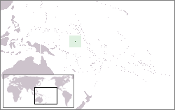
Location map for the Nauru.
Originally created for English Wikipedia by Vardion.
| |
এই কাজের প্রণেতা Vardion উইকিমিডিয়া কমন্স প্রকল্পের কাজটি পাবলিক ডোমেইনে প্রকাশ করেছেন। এটি বিশ্বব্যাপী প্রযোজ্য হবে। যে ক্ষেত্রে এটি আইনত সম্ভব নয়: |
ফাইলের ইতিহাস
যেকোনো তারিখ/সময়ে ক্লিক করে দেখুন ফাইলটি তখন কী অবস্থায় ছিল।
| তারিখ/সময় | সংক্ষেপচিত্র | মাত্রা | ব্যবহারকারী | মন্তব্য | |
|---|---|---|---|---|---|
| বর্তমান | ২২:৪৭, ২৭ জানুয়ারি ২০১০ | | ২৫০ × ১৫৮ (৩ কিলোবাইট) | Mahahahaneapneap | Compressed |
| ০৫:০৩, ২৪ ডিসেম্বর ২০০৪ |  | ২৫০ × ১৫৮ (৬ কিলোবাইট) | EugeneZelenko | Location map for the Nauru.<br/>Originally created for English Wikipedia by Vardion.<br/>{{PD}}<br/>Category:Country locator maps |
সংযোগসমূহ
এই ফাইল ব্যবহার করে এমন কোনো পাতা নেই।
ফাইলের বৈশ্বিক ব্যবহার
নিচের অন্যান্য উইকিগুলো এই ফাইলটি ব্যবহার করে:
- af.wikipedia.org-এ ব্যবহার
- ar.wikipedia.org-এ ব্যবহার
- أيزو 3166-2:NR
- بوابة:ناورو
- بوابة:ناورو/واجهة
- معاملة المثليين في ناورو
- مستخدم:جار الله/قائمة صور مقالات العلاقات الثنائية
- العلاقات الأمريكية الناوروية
- العلاقات الأنغولية الناوروية
- العلاقات الكورية الجنوبية الناوروية
- العلاقات الإريترية الناوروية
- العلاقات السويسرية الناوروية
- العلاقات الألمانية الناوروية
- العلاقات الليختنشتانية الناوروية
- العلاقات البوليفية الناوروية
- العلاقات الموزمبيقية الناوروية
- العلاقات الألبانية الناوروية
- العلاقات البلجيكية الناوروية
- العلاقات الإثيوبية الناوروية
- العلاقات البيلاروسية الناوروية
- العلاقات الطاجيكستانية الناوروية
- العلاقات الروسية الناوروية
- العلاقات الرومانية الناوروية
- العلاقات الأرجنتينية الناوروية
- العلاقات الغامبية الناوروية
- العلاقات القبرصية الناوروية
- العلاقات السيراليونية الناوروية
- العلاقات الناوروية النيبالية
- العلاقات الليبيرية الناوروية
- العلاقات التشيكية الناوروية
- العلاقات الميانمارية الناوروية
- العلاقات الكندية الناوروية
- العلاقات العراقية الناوروية
- العلاقات البريطانية الناوروية
- العلاقات الكوبية الناوروية
- العلاقات الكورية الشمالية الناوروية
- العلاقات الكوستاريكية الناوروية
- العلاقات الكولومبية الناوروية
- العلاقات الكيريباتية الناوروية
- العلاقات الكينية الناوروية
- العلاقات اللاتفية الناوروية
- العلاقات اللاوسية الناوروية
- العلاقات اللبنانية الناوروية
- العلاقات اللوكسمبورغية الناوروية
- العلاقات الليبية الناوروية
- العلاقات الليتوانية الناوروية
- العلاقات الليسوتوية الناوروية
- العلاقات المالاوية الناوروية
- العلاقات المالطية الناوروية
- العلاقات المالية الناوروية
- العلاقات الماليزية الناوروية
এই ফাইলের অন্যান্য বৈশ্বিক ব্যবহার দেখুন।