চিত্র:Leicestershire UK location map.svg

এই SVG ফাইলের জন্য এই PNG প্রাকদর্শনের আকার: ৭৬১ × ৬০০ পিক্সেল। অন্যান্য আকারসমূহ: ৩০৫ × ২৪০ পিক্সেল | ৬০৯ × ৪৮০ পিক্সেল | ৯৭৫ × ৭৬৮ পিক্সেল | ১,২৮০ × ১,০০৯ পিক্সেল | ২,৫৬০ × ২,০১৭ পিক্সেল | ১,৪২৫ × ১,১২৩ পিক্সেল।
পূর্ণ রেজোলিউশন (এসভিজি ফাইল, সাধারণত ১,৪২৫ × ১,১২৩ পিক্সেল, ফাইলের আকার: ২.২৩ মেগাবাইট)
| এই ফাইলটি উইকিমিডিয়া কমন্স থেকে নেওয়া। সেখানের বর্ণনা পাতার বিস্তারিত নিম্নে দেখানো হলো। (সম্পাদনা)
|
| বিবরণ |
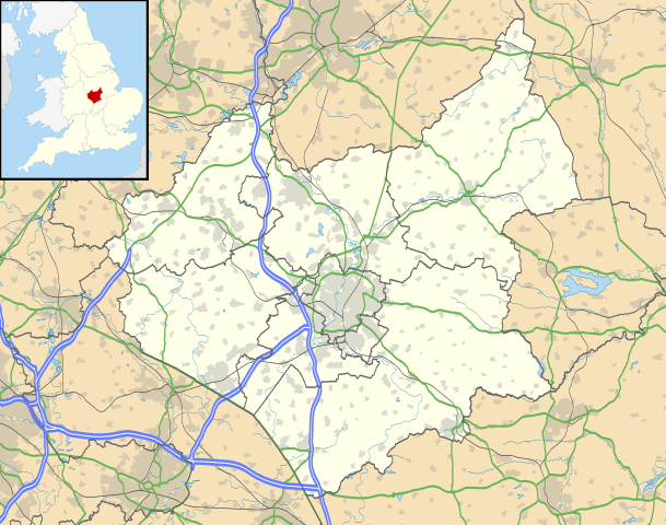
Map of Leicestershire, UK with the following information shown:
Equirectangular map projection on WGS 84 datum, with N/S stretched 160% Geographic limits:
|
| তারিখ | |
| উৎস |
|
| লেখক | Nilfanion, created using Ordnance Survey data |
| অনুমতি (এ ফাইলের পুনঃব্যবহার) |
এই ফাইলটি ক্রিয়েটিভ কমন্স অ্যাট্রিবিউশন-শেয়ার অ্যালাইক ৩.০ আনপোর্টেড লাইসেন্সের আওতায় লাইসেন্সকৃত। স্বীকৃতিপ্রদান: Contains Ordnance Survey data © Crown copyright and database right
|
| অন্যান্য সংস্করণ | File:Leicestershire UK district map (blank).svg - Blank map |
.svg)
ফাইলের ইতিহাস
যেকোনো তারিখ/সময়ে ক্লিক করে দেখুন ফাইলটি তখন কী অবস্থায় ছিল।
| তারিখ/সময় | সংক্ষেপচিত্র | মাত্রা | ব্যবহারকারী | মন্তব্য | |
|---|---|---|---|---|---|
| বর্তমান | ১৯:০০, ২৬ সেপ্টেম্বর ২০১০ | | ১,৪২৫ × ১,১২৩ (২.২৩ মেগাবাইট) | Nilfanion | {{Information |Description=Map of Leicestershire, UK with the following information shown: *Administrative borders *Coastline, lakes and rivers *Roads and railways *Urban areas Equirectangular map projection on WGS 84 datum, with N/S |
সংযোগসমূহ
নিচের পৃষ্ঠা(গুলো) থেকে এই ছবিতে সংযোগ আছে:
ফাইলের বৈশ্বিক ব্যবহার
নিচের অন্যান্য উইকিগুলো এই ফাইলটি ব্যবহার করে:
- ar.wikipedia.org-এ ব্যবহার
- bg.wikipedia.org-এ ব্যবহার
- ceb.wikipedia.org-এ ব্যবহার
- cs.wikipedia.org-এ ব্যবহার
- en.wikipedia.org-এ ব্যবহার
- Quorn, Leicestershire
- Walton, Leicestershire
- Belvoir Castle
- Ashby-de-la-Zouch
- Breedon on the Hill
- Kirby Muxloe
- Moira, Leicestershire
- Foxton Locks
- Market Harborough
- Lutterworth
- Ashby de la Zouch Castle
- Donisthorpe
- Loughborough
- Melton Mowbray
- East Midlands Airport
- Wigston
- Hinckley
- Coalville
- Earl Shilton
- Barwell
- Burbage, Leicestershire
- Glenfield, Leicestershire
- Bradgate Park
- Kegworth
- National Space Centre
- Oadby
- Market Bosworth
- Carlton, Leicestershire
- Frisby on the Wreake
- Shepshed
- Blaby
- Cotes, Leicestershire
- Twycross
- Dadlington
- Buckminster
- Sutton Cheney
- Wycomb
- Bruntingthorpe Aerodrome
- Foxton Inclined Plane
- Desford
- Aylestone
- Rothley
- Belgrave, Leicester
- Knighton, Leicester
এই ফাইলের অন্যান্য বৈশ্বিক ব্যবহার দেখুন।