চিত্র:IGI1908Beluchistan2.jpg

এই প্রাকদর্শনের আকার: ৭২৩ × ৫৯৯ পিক্সেল। অন্যান্য আকারসমূহ: ২৯০ × ২৪০ পিক্সেল | ৫৭৯ × ৪৮০ পিক্সেল | ৯২৬ × ৭৬৮ পিক্সেল | ১,২০০ × ৯৯৫ পিক্সেল।
পূর্ণ রেজোলিউশন (১,২০০ × ৯৯৫ পিক্সেল, ফাইলের আকার: ৩৭২ কিলোবাইট, এমআইএমই ধরন: image/jpeg)
| এই ফাইলটি উইকিমিডিয়া কমন্স থেকে নেওয়া। সেখানের বর্ণনা পাতার বিস্তারিত নিম্নে দেখানো হলো। (সম্পাদনা)
|
সারাংশ
| বর্ণনা |
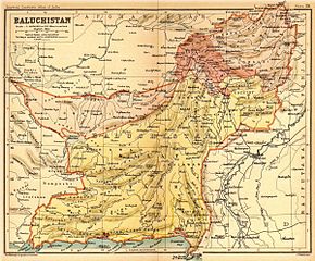
English: Map of Beluchistan |
|||||||||
| তারিখ | ||||||||||
| উৎস | Imperial Gazetteer of India, volume 26, Atlas, Oxford University Press. 1908. Scanned from personal copy, reduced, and uploaded by Fowler&fowler«Talk» 22:36, 8 March 2009 (UTC) | |||||||||
| স্রষ্টা |
J. G. Bartholomew and Co., Edinburgh |
|||||||||
| Geotemporal data | ||||||||||
| ভৌগলিক সীমা |
|
|||||||||
| Warper-এ মানচিত্রের আস্তরণ | ||||||||||
লাইসেন্স প্রদান
লেখক ১৯২০ সালে মারা যান, তাই এই কর্মটি এর উৎস দেশে পাবলিক ডোমেইনে রয়েছে এবং অন্যান্য দেশ ও অঞ্চলে যেখানে কপিরাটের সময়সীমা হচ্ছে লেখকের জীবন যোগ ১০০ বছর বা তাঁর কম। | |
| এই ফাইলটি কপিরাইট আইনের আওতায় জানা সকল বাধানিষেধ মুক্ত বলে চিহ্নিত হয়েছে, যার মধ্যে সম্পর্কিত সকল স্বত্ব ও নেইবারিং সত্ত্ব সংযুক্ত। | |
মূল আপলোড লগ
মূল বিবরণ পাতাটি এখানে ছিল। নিম্নলিখিত সকল ব্যবহারকারীর নাম en.wikipedia-এ উল্লেখ করা ছিল।
- 2010-04-18 16:18 Beao 1200×995× (380628 bytes)
- 2009-03-08 22:36 Fowler&fowler 1200×995× (345178 bytes) {{Information |Description=Map of Beluchistan from ''Imperial Gazetteer of India'', volume 26, Atlas, Oxford University Press. 1908. Scanned from personal copy, reduced, and uploaded by ~~~~ |Source=''Imperial Gazetteer of India'', volume 26, Atlas, Oxf
ফাইলের ইতিহাস
যেকোনো তারিখ/সময়ে ক্লিক করে দেখুন ফাইলটি তখন কী অবস্থায় ছিল।
| তারিখ/সময় | সংক্ষেপচিত্র | মাত্রা | ব্যবহারকারী | মন্তব্য | |
|---|---|---|---|---|---|
| বর্তমান | ২১:৩৬, ১৯ নভেম্বর ২০১১ | | ১,২০০ × ৯৯৫ (৩৭২ কিলোবাইট) | OgreBot | (BOT): Reverting to most recent version before archival |
| ২১:৩৫, ১৯ নভেম্বর ২০১১ |  | ১,২০০ × ৯৯৫ (৩৩৭ কিলোবাইট) | OgreBot | (BOT): Uploading old version of file from en.wikipedia; originally uploaded on 2009-03-08 22:36:49 by Fowler&fowler | |
| ১১:২৯, ২ মার্চ ২০১১ |  | ১,২০০ × ৯৯৫ (৩৭২ কিলোবাইট) | MALLUS | {{Information |Description=Map of Beluchistan from ''Imperial Gazetteer of India'', volume 26, Atlas, Oxford University Press. 1908. Scanned from personal copy, reduced, and uploaded by [[User:Fowler&fowler|<font color="#B8860B">Fowler&fowler</f |
সংযোগসমূহ
নিচের পৃষ্ঠা(গুলো) থেকে এই ছবিতে সংযোগ আছে:
ফাইলের বৈশ্বিক ব্যবহার
নিচের অন্যান্য উইকিগুলো এই ফাইলটি ব্যবহার করে:
- ca.wikipedia.org-এ ব্যবহার
- it.wikipedia.org-এ ব্যবহার
- no.wikipedia.org-এ ব্যবহার
- pt.wikipedia.org-এ ব্যবহার
- ta.wikipedia.org-এ ব্যবহার
- te.wikipedia.org-এ ব্যবহার